Trail Mountain bike La Capelle-et-Masmolène - De Masmolène à Vallabrix - Photo

De Masmolène à Vallabrix

 tracegps
tracegps

User

© OpenStreetMap contributors
Length
Length
18.1 km
Max alt
Max alt
249 m
Uphill gradient
Uphill gradient
269 m
Km-Effort
Km-Effort  
22 km
Min alt
Min alt
140 m
Downhill gradient
Downhill gradient
269 m
Boucle
Boucle
Yes
Creation date :
2014-12-10 00:00:00.0
Updated on :
2014-12-10 00:00:00.0

(0 Reviews)

Mountain bike
Mountain bike
2h30
Difficulty : Medium

Scan this QR Code to open this trail in the SityTrail application

FREE GPS app for hiking

Logo SityTrail SityTrail

IGN / Geographical institutes

Download SityTrail from the App Store Download SityTrail from Google Play

Logo SityTrail SityTrail World

The world is yours!

Download SityTrail from the App Store Download SityTrail from Google Play Download SityTrail on Huawei AppGallery

About

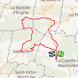
Trail Mountain bike of 18.1 km to be discovered at Occitania, Gard, La Capelle-et-Masmolène. This trail is proposed by tracegps.

Description

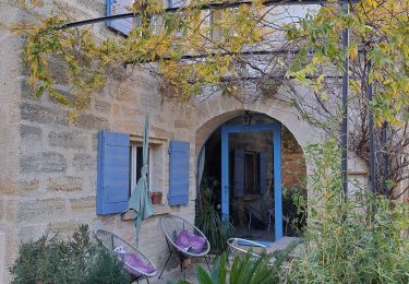
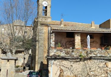
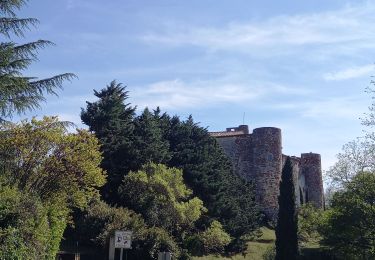
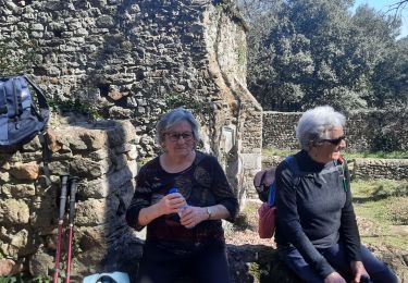
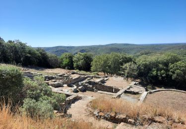
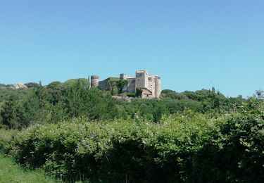
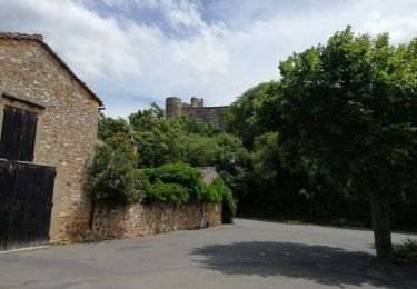
Randonnée dans le paysage ouvert de l'Uzège et les charmants villages, traversée des Bois de Vallabrix et Les Grands Bois. Parking au hameau de Masmolène, route de Vallabrix. Suivre le balisage vers le nord, puis par l'ouest vers le Mas Moutet. Dans Vallabrix, aller voir le lavoir et sa machinerie de pompage avant de poursuivre à travers les ruelles. Au nord, traverser les bois de Vallabrix et Les Grands Bois. En vue de la Bastide d'Engras, aller vers l'est en longeant les vignobles. Après Pougnadoresse, revenir par le sud vers Masmolène en suivant le balisage. Bonne rando.

Elevation profile

Photos

Positioning

Country:
France
Region :
Occitania
Department/Province :
Gard
Municipality :
La Capelle-et-Masmolène
Location:
Unknown
Start:(UTM)
621740 ; 4878916 (31T) N.

Trails nearby

Trail Walking Pouzilhac - Le sentier botanique - Pouzilhac - Photo
Walking
tracegps

Walking

Difficult
(4)
Pouzilhac, Occitania, Gard, France
11.3 km | 14 km-effort
3h 30min
Yes
Trail Walking La Capelle-et-Masmolène - Masmolène et l'étang de la Capelle - Photo
Walking
jesusmarieclaire

Walking

Very easy
(1)
La Capelle-et-Masmolène, Occitania, Gard, France
14.4 km | 16.8 km-effort
3h 37min
No
Trail Walking Saint-Siffret - au départ de St Siffrey - Photo
Walking
GUIDE
nadinebondoux

Walking

Medium
Saint-Siffret, Occitania, Gard, France
18.2 km | 22 km-effort
5h 27min
Yes
Trail Walking La Capelle-et-Masmolène - La Capelle-et-Masmolène - Photo
Walking
Gegetop

Walking

Easy
La Capelle-et-Masmolène, Occitania, Gard, France
7.7 km | 9.1 km-effort
2h 8min
Yes
Trail Walking La Capelle-et-Masmolène - la Capelle Masmolène - Photo
Walking
GUIDE
nadinebondoux

Walking

Medium
La Capelle-et-Masmolène, Occitania, Gard, France
16.8 km | 21 km-effort
5h 45min
Yes
Trail Walking Gaujac - Gaujac 160323 - Photo
Walking
fario

Walking

Difficult
Gaujac, Occitania, Gard, France
11 km | 14.3 km-effort
3h 15min
Yes
Trail Walking Le Pin - Le pin , la Garbie et oppidum - Photo
Walking
jcguew

Walking

Medium
Le Pin, Occitania, Gard, France
6.3 km | 8.3 km-effort
2h 42min
No
Trail Mountain bike La Capelle-et-Masmolène - 30-vtt-lacapelle-St-Siffret-25km-230m-juin21 - Photo
Mountain bike
SyMA

Mountain bike

Medium
La Capelle-et-Masmolène, Occitania, Gard, France
25 km | 28 km-effort
2h 41min
Yes
Trail Walking La Capelle-et-Masmolène - 30-lacapelle-forets-15km-240m-juin21 - Photo
Walking
SyMA

Walking

Medium
La Capelle-et-Masmolène, Occitania, Gard, France
14.9 km | 18.1 km-effort
3h 37min
Yes


Close
My subscriptions